Al-Idrisi's world map, 1154 (C004/3861) Kids Hoodie
1100s Kids Hoodie
designed and sold by SciencePhoto
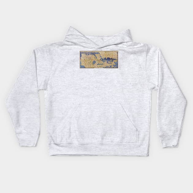
Al-Idrisi's world map. This world map, known as the 'Tabula Rogeriana', dates from 1154, and is orientated with North at bottom. It was drawn by Muhammad Al-Idrisi (1100-1165), an Islamic and Andalusian scholar working for King Roger II of Sicily. It is considered to have been the most accurate world map for the next three centuries. Regions shown include Europe (lower right), the Mediterranean Sea (centre right), North Africa (upper right), the Arabian Peninsula (upper centre), the Black Sea and Caspian Sea (lower centre), and parts of Asia (left). This is a restoration and transliteration carried out in 1927 by the German scholar Konrad Miller (1844-1933).

More Al-Idrisi's world map, 1154 (C004/3861) Products
People Love TeePublic!
Not what you're looking for?
Try another search.
Product Quality
Our Production Team establishes the highest quality standards for third-party printers who participate in the marketplace to ensure that every product sold is perfect.

1100s Kids Hoodie FAQ
UPS MI Domestic (6-8 Business Days)
FedEx 2-Day (4-6 Business Days)
Estimates include printing and processing time.More Shipping Info
We want you to love your order! If for any reason you don't, let us know and we’ll make things right.Learn More
Similar to Al-Idrisi's world map, 1154 (C004/3861) Kids Hoodie
More 1100s products
Customers Also Search
More content to explore
Artist's Applied Tags
Trending Tags
The links above have been automatically generated based on tag usage by third-party designers on the TeePublic platform.